

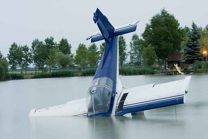
When a light aircraft disappears over warm, shallow seas close to home, the difference between rumor and reality is the discipline of search and rescue: who coordinates, how the last-known position is derived, and why early public details feel sparse even as aircraft and boats are already fanning out over the water.
At a Glance
- A PA-34 Piper carrying four family members vanished en route from the Bahamas to Florida; the search concentrated west of Andros Island.
- Bahamian authorities led the operation and requested U.S. Coast Guard assistance; U.S. air and maritime assets joined the hunt.
- Route, tail number, and last radio/radar position were reported by officials; cause remained undetermined in the initial phase.
- Over-water searches hinge on probabilistic planning and drift modeling; concrete findings often follow days after the first missing-aircraft alert.
What Happened: The core facts and the search corridor
A small twin-engine PA-34 Piper, identified by Bahamian police by tail number N212ML, disappeared while flying from Great Harbour Cay in the Bahamas to Miami Executive Airport in Florida with four family members aboard. Air traffic control lost contact near the west of Andros Island—reports converged on a last-known area roughly a dozen miles off Andros’ western coast—and Bahamian authorities notified the United States for support. The U.S. Coast Guard confirmed it was assisting at the request of the Bahamas, deploying search aircraft to sweep the last reported position and adjacent drift boxes as weather allowed.
The flight profile described by local and national outlets is consistent: a late-morning departure from Great Harbour Cay, a planned return to South Florida, and a loss of contact over the Andros corridor. Officials described the aircraft type and occupants count, anchoring the public narrative to verifiable elements even as the cause of the disappearance remained unknown during active search operations.
How Over-Water Aviation Searches Actually Work
Early reports tend to prioritize operations—who’s searching, where, and with what—because the technical “why” takes time. Over water, the last-known position is an estimate with error bars; planners must infer likely impact points from the last radar hit, radio position, ADS-B returns if any, and crew reports. Search coordinators then account for wind, current, and time since last contact to project drift of debris or rafts, creating search areas that expand—and migrate—hour by hour. The method is codified in SAR doctrine and, in complex cases, strengthened by Bayesian updating: start with a probabilistic map of where the aircraft or survivors likely are, then refine that map as sorties return with detections or negative results.
In the Bahamas, responsibility aligns with geography. The Bahamas lead within their search and rescue region, while the U.S. Coast Guard supports with maritime aircraft such as the HC-144 Ocean Sentry and cutters when requested. That binational rhythm is routine in the Florida–Bahamas air and sea corridor, where recreational and general aviation traffic is dense and weather can deteriorate quickly along shallow banks and deep channels.
Weather, Drift, and The Limits of Early Certainty
Even in coastal waters, search science resists simplicity. Surface debris can diverge from a seafloor wreck by miles in a single tide cycle; windage—the way wind pushes objects of different shapes—creates separation between a life vest, a seat cushion, and an oil sheen. Search masters combine forecast and observed winds, currents, and sea state to model that divergence, then allocate aircraft and vessels to maximize the probability of detection within daylight, fuel, and crew limits. The procedure is neither guesswork nor magic; it is a disciplined application of oceanography and probability under severe time pressure.
That is why the public record in the first 24–72 hours can feel thin: authorities confirm the aircraft, route, and last contact; they specify the area searched and request mariners and pilots to report sightings; they stop short of theorizing cause. Only when debris is positively identified, bodies are recovered, or the airframe is located does the narrative harden. In prior high-profile cases, the timeline from disappearance to definitive findings stretched from days to weeks—even with far more sensors in the mix—because the ocean imposes its own terms.
The Bahamas–South Florida Flight Lane: Familiar Risks on a Short Hop
For pilots and families, a Great Harbour Cay–to–Miami hop feels local, but its hazards are oceanic: convective weather over warm water, rapid cloud build-ups that obscure visual horizons, and few places to set down if engines stumble. Twin-engine reliability helps, yet general aviation twins still depend on pilot workload, systems health, and navigation choices through weather cells. When visibility collapses or precipitation rates rise, spatial disorientation and controlled flight into water remain perennial killers in light aircraft. Investigators therefore examine weather products against track data, maintenance history, and weight-and-balance records to reconstruct the final minutes once the aircraft or significant debris are recovered.
In this case, authorities and multiple outlets anchored the search west of Andros—the largest island in the Bahamas archipelago with vast shallow banks to the west and the deep Tongue of the Ocean to the east. That geography matters: the banks’ shallow, sandy bottom can scatter light debris and complicate sonar, while tidal flows through channels can disperse floating items quickly. Search plans reflect those constraints in grid sizing and asset selection.
What Gets Confirmed, When, and By Whom
Three types of confirmation move a case from missing to explained. First, operational confirmation: the lead SAR authority specifies last-known position, search assets, and outcomes. Here, Bahamian officials and the U.S. Coast Guard publicly described roles and search zones and confirmed the request for U.S. assistance. Second, material confirmation: the identification of debris, bodies, or the primary wreckage. Positive identifications, when they occur, are usually announced by the lead authority after forensic checks. Third, causal confirmation: the accident investigator’s preliminary and final reports, which assign probable cause after analyzing wreckage, maintenance, operations, and environment. In the Bahamas, that role sits with national aviation investigators, who publish preliminary findings before a final report once evidence is complete.
The cadence exists for good reason. It prevents premature causal claims and ensures families are notified before details reach the public. It also keeps search crews focused on detection and recovery rather than adjudicating theories mid-mission. The public’s best window into real progress is often the plain language in agency updates and the specificity of locations and assets cited—an indicator that planners have enough data to narrow the grid.
🇺🇸 A son went searching for his missing family himself and made the discovery nobody wanted.
Mario and Lili Lamar were flying back to Florida from the Bahamas with two of their grandchildren when their private plane crashed near North Andros Island yesterday.
Bad weather… pic.twitter.com/6rcuxJFpil
— Mario Nawfal (@MarioNawfal) September 8, 2026
Why This Matters Beyond One Tragedy
General aviation over water is a lifeline for families, businesses, and communities across the Bahamas–Florida corridor. The discipline seen in this search—clear jurisdiction, rapid cross-border assistance, and methodical over-water search techniques—is the difference between a chaotic hunt and a professional one. For pilots, the case underscores several enduring practices: respect convective forecasts over the banks, plan alternates that are truly reachable, file and update flight plans that aid SAR, and ensure emergency locator transmitters and portable beacons are modern and functional. For families, clarity about who calls whom, and when, can shave hours off the initial response.
Sources:
cbsnews.com, cbs12.com, cnn.com, faa.gov